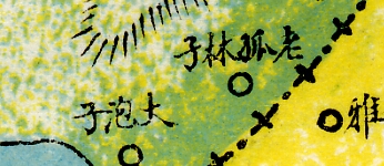
actual pixels sample:

DOWNLOAD FULL SIZE IMAGES: http://dx.doi.org/10.7910/DVN/23336
(Harvard Library catalog record)
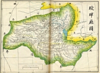
scale: 469,000:1 (as noted on map)
original plate size: 46cm X 36cm
scan resolution: 350dpi
This plate covers the area around present day Heihe Shi.
Geographic footprint:
Maximum North 50.15 N
Maximum South 49.80 N
Maximum East: 127.70 E
Maximum West: 126.45 E
Each map is printed on two pages, and each page has been scanned separately. The size of the uncompressed TIFF files is approximately 50 MB per page. Each TIFF has been compressed into a full-size JPEG of approximately 15-20 MB.